| STC rapid transit | |||||||||||
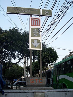
 Entry sign Entry sign | |||||||||||
| General information | |||||||||||
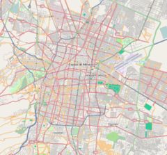
| Location | Barrio de Santa Catarina, Coyoacán Mexico City Mexico | ||||||||||
| Coordinates | 19°21′13″N 99°10′34″W / 19.353724°N 99.176052°W / 19.353724; -99.176052 | ||||||||||
| Line(s) | |||||||||||
| Platforms | 2 side platforms | ||||||||||
| Tracks | 2 | ||||||||||
| Construction | |||||||||||
| Structure type | Underground | ||||||||||
| Platform levels | 1 | ||||||||||
| Parking | No | ||||||||||
| Bicycle facilities | No | ||||||||||
| Accessible | Yes | ||||||||||
| History | |||||||||||
| Opened | 30 August 1983 | ||||||||||
| Previous names | Viveros | ||||||||||
| Passengers | |||||||||||
| 2023 | 5,801,141 | ||||||||||
| Rank | 78/195 | ||||||||||
| Services | |||||||||||
| |||||||||||
| |||||||||||
Viveros / Derechos Humanos (Spanish pronunciation; formerly Viveros) is a metro station along Line 3 of the Mexico City Metro. It is located between the Álvaro Obregón and Coyoacán boroughs of Mexico City.
General information
The station logo depicts the silhouette of a plant, and the metro station is named after the nearby Viveros de Coyoacán arboretum and nursery (parts of which are a publicly accessible park and a popular area for recreation), founded by engineer Miguel Ángel de Quevedo in the former ranch of Panzacola. The station opened on 30 August 1983.
Viveros / Derechos Humanos serves the Colonia Barrio de Santa Catarina, Florida, and Axotla neighborhoods, and is mainly used to link with the bus lines on Avenida Universidad.
Inside the station is a mural by artist Jason Schell entitled A Sunday Afternoon Under Mexico City (Una Tarde Dominical Bajo la Ciudad de Mexico).
Ridership
| Annual passenger ridership | |||||
|---|---|---|---|---|---|
| Year | Ridership | Average daily | Rank | % change | Ref. |
| 2023 | 5,801,141 | 15,893 | 78/195 | +7.80% | |
| 2022 | 5,381,439 | 14,743 | 80/195 | +34.21% | |
| 2021 | 4,009,630 | 10,985 | 76/195 | −10.30% | |
| 2020 | 4,469,994 | 12,213 | 77/195 | −42.15% | |
| 2019 | 7,727,513 | 21,171 | 82/195 | −1.30% | |
| 2018 | 7,829,573 | 21,450 | 82/195 | −2.55% | |
| 2017 | 8,034,608 | 22,012 | 74/195 | −5.42% | |
| 2016 | 8,495,111 | 23,210 | 72/195 | −0.26% | |
| 2015 | 8,517,180 | 23,334 | 67/195 | −1.83% | |
| 2014 | 8,676,216 | 23,770 | 66/195 | −5.50% | |
Nearby
- Viveros de Coyoacán, public 38.9 hectares park.
Exits
- East: Avenida Universidad, Barrio de Santa Catarina
- West: Avenida Universidad and Hortensia street, Barrio de Santa Catarina
References
- ^ "Afluencia de estación por línea 2023" [Station traffic per line 2023] (in Spanish). Sistema Transporte Colectivo Metro. 2024. Archived from the original on 27 January 2024. Retrieved 24 January 2024.
- ^ "Viveros / Derechos Humanos" (in Spanish). Sistema de Transporte Colectivo. Archived from the original on 10 October 2011. Retrieved 20 August 2011.
- Archambault, Richard. "Viveros » Mexico City Metro System". Retrieved 20 August 2011.
- Monroy, Marco. Schwandl, Robert (ed.). "Opening Dates for Mexico City's Subway". Retrieved 14 August 2011.
- "Afluencia de estación por línea 2021" [Station traffic per line 2021] (in Spanish). Sistema Transporte Colectivo Metro. 2020. Archived from the original on 7 March 2022. Retrieved 7 March 2022.
- "Afluencia de estación por línea 2020" [Station traffic per line 2020] (in Spanish). Sistema Transporte Colectivo Metro. 2021. Archived from the original on 21 June 2021. Retrieved 21 June 2021.
- "Afluencia de estación por línea 2019" [Station traffic per line 2019] (in Spanish). Sistema Transporte Colectivo Metro. 2020. Archived from the original on 8 April 2020. Retrieved 3 May 2020.
- "Afluencia de estación por línea 2018" [Station traffic per line 2018] (in Spanish). Sistema Transporte Colectivo Metro. 2019. Archived from the original on 6 June 2019. Retrieved 7 April 2020.
- "Afluencia de estación por línea 2017" [Station traffic per line 2017] (in Spanish). Sistema Transporte Colectivo Metro. 2019. Archived from the original on 3 May 2020. Retrieved 3 May 2020.
- "Afluencia de estación por línea 2016" [Station traffic per line 2016] (in Spanish). Sistema Transporte Colectivo Metro. 2017. Archived from the original on 3 May 2020. Retrieved 3 May 2020.
- "Afluencia de estación por línea 2015" [Station traffic per line 2015] (in Spanish). Sistema Transporte Colectivo Metro. 2016. Archived from the original on 3 May 2020. Retrieved 6 May 2020.
- "Afluencia de estación por línea 2014" [Station traffic per line 2014] (in Spanish). Sistema Transporte Colectivo Metro. 2015. Archived from the original on 3 May 2020. Retrieved 6 May 2020.
External links
| Mexico City Metro stations | |
|---|---|
| |
| Álvaro Obregón, Mexico City | |
|---|---|
| Areas | |
| Schools |
|
| Mexico City Metro stations | |
| Landmarks | |
| Other topics | Borough of Álvaro Obregón topics |
| This list is incomplete. | |
| Coyoacán | |
|---|---|
| Neighborhoods | |
| Schools | |
| Colleges and universities | |
| Mexico City Metro stations | |
| Museums | |
| Parks | |
| Buildings | |
| This list is incomplete. Coyoacán metro station is in Benito Juárez district | |
This Mexico metro station article is a stub. You can help Misplaced Pages by expanding it. |
