| Revision as of 04:44, 11 October 2023 edit185.81.141.38 (talk) →Cities and townsTags: Mobile edit Mobile web edit← Previous edit | Revision as of 16:25, 19 April 2024 edit undoAnarchxstRanger (talk | contribs)39 edits fixed population using latest data from 2017. doing this for most districts of lebanonNext edit → | ||
| Line 85: | Line 85: | ||
| |population_footnotes = | |population_footnotes = | ||
| |population_note = | |population_note = | ||
| | population_est = 57,339 | |||
| ⚫ | |population_total = |
||
| | pop_est_as_of = 31 December 2017 | |||
| ⚫ | |population_total = | ||
| |population_density_km2 = | |population_density_km2 = | ||
| |population_density_sq_mi = | |population_density_sq_mi = | ||
Revision as of 16:25, 19 April 2024
District in North Governorate, Lebanon| Batroun District | |
|---|---|
| District | |
| البترون | |
 Tannurin El Fawqa, Batroun District Tannurin El Fawqa, Batroun District | |
| Nickname: Fadous | |
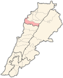
 Location in Lebanon Location in Lebanon | |
| Country | |
| Governorate | North Governorate |
| Capital | Batroun |
| Area | |
| • Total | 111 sq mi (287 km) |
| Population | |
| • Estimate | 57,339 |
| Time zone | UTC+2 (EET) |
| • Summer (DST) | UTC+3 (EEST) |
Batroun District (Template:Lang-ar) is a district (qadaa) in the North Governorate, Lebanon, south of Tripoli. The capital is Batroun. Its borders are created in the south by the river El Jaouz in the north and by the river Madfoun.

Cities and towns
- Aabdelli
- Aabrine
- Aalali
- Aaoura
- Aartiz
- Asia
- Batroun
- Basbina
- Bchaaleh
- Beit Chlala
- Beit Kassab
- Bijdarfil
- Boqsmaiya
- Chatine
- Chekka
- Chibtine
- Daael
- Dahr Abi Yaghi
- Darya
- Deir Billa
- Douma
- Douq
- Eddeh
- Ftahat
- Ghouma
- Hadtoun
- Hamat
- Harbouna
- Hardine
- Heri
- Hilta
- Ijdabra
- Jebla
- Jrabta
- Jran
- Kandoula
- Fadous
- Kfar Chleymane
- Kfar Hatna
- Kfar Hay
- Kfar Hilda
- Kfar Shlaimane
- Kfifane
- Kfour El Arabi
- Koubba
- Kour
- Madfoun
- Mehmarch
- Mar Mama
- Masrah
- Mrah Chdid
- Mrah Ez Ziyat
- Nahla
- Niha, Batroun
- Ouajh El Hajar
- Ouata Houb
- Qandola
- Racha
- Rachana
- Rachkida
- Ram, Batroun
- Ras Nahhach
- Selaata
- Sghar
- Smar Jbeil
- Sourat
- Tannourine El Faouqa
- Thoum
- Toula
- Wata Hob
- Zane
Sources
34°15′N 35°39′E / 34.250°N 35.650°E / 34.250; 35.650
This Lebanon location article is a stub. You can help Misplaced Pages by expanding it. |
