| Gravatnet | |
|---|---|
  | |
| Location | Sirdal, Agder |
| Coordinates | 58°54′15″N 06°45′55″E / 58.90417°N 6.76528°E / 58.90417; 6.76528 |
| Primary inflows | Valevatn lake |
| Primary outflows | Gravassåni river |
| Basin countries | Norway |
| Max. length | 8 kilometres (5.0 mi) |
| Max. width | 2.2 kilometres (1.4 mi) |
| Surface area | 5.33 km (2.06 sq mi) |
| Shore length | 25.29 kilometres (15.71 mi) |
| Surface elevation | 660 metres (2,170 ft) |
| References | NVE |
| Shore length is not a well-defined measure. | |
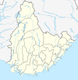
Gravatnet is a lake in the municipality of Sirdal in Agder county, Norway. The 5.33-square-kilometre (2.06 sq mi) lake is located about 9 kilometres (5.6 mi) north of the small village of Lunde. The lake lies immediately south of the lake Valevatn, which flows out into Gravatnet. The water in Gravatnet is stopped by a dam on the south side. The water is regulated at an elevation of 660 metres (2,170 ft) and it flows out through the small river Gravassåni which is a tributary of the big river Sira.
See also
References
- "Gravatn, Sirdal (Vest-Agder)" (in Norwegian). yr.no. Retrieved 2016-08-14.