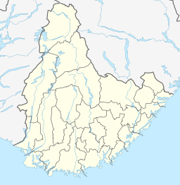
| Kumlevollvatnet | |
|---|---|
| Kongevollvatnet | |
  | |
| Location | Flekkefjord, Agder |
| Coordinates | 58°21′36″N 06°50′02″E / 58.36000°N 6.83389°E / 58.36000; 6.83389 |
| Primary inflows | Gylandelva river |
| Primary outflows | Fedaelva river |
| Basin countries | Norway |
| Max. length | 3.5 kilometres (2.2 mi) |
| Max. width | 2 kilometres (1.2 mi) |
| Surface area | 3.12 km (1.20 sq mi) |
| Shore length | 18.23 kilometres (11.33 mi) |
| Surface elevation | 111 metres (364 ft) |
| References | NVE |
| Shore length is not a well-defined measure. | |
Kumlevollvatnet or Kongevollvatnet is a lake in the municipality of Flekkefjord in Agder county, Norway. The 3.12-square-kilometre (1.20 sq mi) lake lies along the river Fedaelva, just south of Gyland and about 12 kilometres (7.5 mi) northeast of the town of Flekkefjord.
See also
References
- "Kongevollvatnet" (in Norwegian). yr.no. Retrieved 2016-09-07.
This article related to a lake in Agder in Norway is a stub. You can help Misplaced Pages by expanding it. |