| Nabatieh | |
|---|---|
| District | |
 Nabatieh District Nabatieh District | |
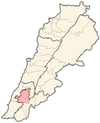
 Location in Lebanon Location in Lebanon | |
| Country | |
| Governorate | Nabatieh Governorate |
| Capital | Nabatieh |
| Area | |
| • Total | 117 sq mi (304 km) |
| Population | |
| • Estimate | 155,233 |
| Time zone | UTC+2 (EET) |
| • Summer (DST) | UTC+3 (EEST) |
The Nabatieh District is a district in the Nabatieh Governorate of Lebanon. The capital of the district is Nabatieh.
Municipalities
The following 42 municipalities are all located in the Nabatieh District:
- Aadshit
- Ain Bouswar
- Ain Qana
- Ansar
- Arabsalim
- Arnoun
- Aazze
- Braiqaa
- Deir ez-Zahrani
- Ad-Doueir
- Ebba
- Habboush
- Harouf
- Houmin al-Fawqa
- Houmin al-Tahta
- Jarjouaa
- Jbaa
- Jibshit
- Kfar Fila
- Kfar Reman
- Kfar Sir
- Kfar Tebnit
- Kfaroue
- Al-Kfour
- Mayfadoun
- Nabatieh
- Nabatieh al-Fawqa
- Al-Numairiyah
- Qaaqaait al-Jisr
- Al-Qusaibah
- Roumin
- Sarba
- Al-Sharqiyah
- Shoukin
- Sini
- Sir al-Gharbiyah
- Toul
- Yohmor
- Zawtar al-Gharbiyah
- Zawtar al-Sharqiyah
- Zebdin
- Zefta
Demographics
According to registered voters in 2014:
| Year | Christians | Muslims | Druze | ||||||
|---|---|---|---|---|---|---|---|---|---|
| Total | Maronites | Greek Catholics | Other Christians | Total | Shias | Sunnis | Alawites | Druze | |
| 2014 | 3.84% | 2.79% | 0.75% | 0.30% | 95.79% | 93.49% | 2.29% | 0.02% | 0.01% |
References
External links
33°22′44″N 35°28′50″E / 33.37889°N 35.48056°E / 33.37889; 35.48056
This Lebanon location article is a stub. You can help Misplaced Pages by expanding it. |
