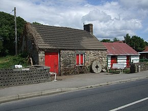
 R352 road
 | |
|---|---|
| Bóthar R352 | |
 Mountshannon, County Clare, on the R352 Mountshannon, County Clare, on the R352 | |
| Route information | |
| Length | 73.2 km (45.5 mi) |
| Major junctions | |
| From | |
| Major intersections | Passes through Mountshannon Enters County Galway Crosses Woodford River (Clonco Bridge) Crosses Cappagh River |
| To | |
| Location | |
| Country | Ireland |
| Highway system | |
The R352 road is a regional road in Ireland, located in County Clare and County Galway.
References
- "R352 - Roader's Digest: The SABRE Wiki". www.sabre-roads.org.uk.
- "S.I. No. 54/2012 - Roads Act 1993 (Classification of Regional Roads) Order 2012". irishstatutebook.ie. Retrieved 22 June 2020.
53°03′12″N 8°21′02″W / 53.053219°N 8.350431°W / 53.053219; -8.350431
This Irish road or road transport-related article is a stub. You can help Misplaced Pages by expanding it. |