 R629 road
 | ||||
|---|---|---|---|---|
| Bóthar R629 | ||||
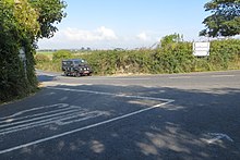
 R629 south of Shanagarry R629 south of Shanagarry | ||||
| Route information | ||||
| Length | 16.4 km (10.2 mi) | |||
| Major junctions | ||||
| From | ||||
| Major intersections | ||||
| To | Ballycotton | |||
| Location | ||||
| Country | Ireland | |||
| Highway system | ||||
| ||||

The R629 road is a regional road in southeast County Cork, Ireland. It travels from the R630 road at Ballinacurra's grotto, southeastwards through Kearney's Cross and Cloyne (where it turns eastwards), past Ballymaloe House and Shanagarry, into Ballycotton. The statutary definition gives it as beginning at the R907 in Midleton, but all maps and other material assign the Midleton–Ballinacurra stretch to the R630 instead.
References
- ^ "S.I. No. 54/2012 – Roads Act 1993 (Classification of Regional Roads) Order 2012". Government of Ireland. 28 February 2012. Retrieved 14 November 2020.
- "Ready for its close-up". The Irish Times.
- Guides, Rough (1 December 2021). The Rough Guide to Ireland (Travel Guide eBook). Apa Publications (UK) Limited. ISBN 9781789197310 – via Google Books.
- "Alert Item". mapalerts.corkcoco.ie.
- "Wild Animals & Wild History". 21 December 2009.
- "Temporary Closing Of Public Roads". Cork County Council.
51°52′03″N 8°05′56″W / 51.86745°N 8.09895°W / 51.86745; -8.09895
This Irish road or road transport-related article is a stub. You can help Misplaced Pages by expanding it. |